
Bethel, Ohio
Bethel, Ohio | |
|---|---|
 Location of Bethel, Ohio | |
 Location of Bethel in Clermont County | |
| Coordinates: 38°57′46″N 84°05′05″W / 38.96278°N 84.08472°W | |
| Country | United States |
| State | Ohio |
| County | Clermont |
| Township | Tate |
| Area | |
| • Total | 1.43 sq mi (3.71 km2) |
| • Land | 1.43 sq mi (3.70 km2) |
| • Water | 0.01 sq mi (0.01 km2) |
| Elevation | 873 ft (266 m) |
| Population (2020) | |
| • Total | 2,620 |
| • Estimate (2023)[3] | 2,659 |
| • Density | 1,836.02/sq mi (708.73/km2) |
| Time zone | UTC-5 (Eastern (EST)) |
| • Summer (DST) | UTC-4 (EDT) |
| ZIP code | 45106 |
| Area code | 513 |
| FIPS code | 39-06068[4] |
| GNIS feature ID | 2398110[2] |
| Website | bethel-oh |
Bethel is a village in Tate Township, Clermont County, Ohio, United States. The population was 2,620 at the 2020 census and Tate Township as a whole was 9,162.
History
[edit]The village of Bethel is located in Clermont County, Ohio, United States. Bethel is the home of the first movie theater in Ohio which was founded in 1908. A post office in Bethel has been in operation since 1815.
[edit]American Indians:
[edit]The Adena people inhabited the area of Elklick in Bethel from approximately 800 B.C. to A.D. 100. There they left us a historical Indian Mound that has been preserved by the East Fork State Park.
[edit]State Route 133 Once know as Bullskin Trace between Bethel and Williamsburg follows a path previously used by Shawnee Indians and General Anthony Wayne and his troops.
[edit]Here is some history of State Route 133:
[edit]Prehistorically, the trace crossed the Ohio River to the salt licks farther south in Kentucky.
[edit]The Shawnee Indians used the trace to reach sacred hunting grounds and the salt licks.
[edit]1793, General Wayne improved the trace so he could fight Indians in northern Ohio.
[edit]1807 – 1808, the Ohio Legislature established the road as the Xenia State Road. At that time, $700 was obtained to buy land to create a 20-foot right of way. That 60 foot width remains.
[edit]War of 1812, the road was improved so supplies could be hauled to Detroit and Sandusky for ships on the Great Lakes.
[edit]Pre-Civil War period, the road became an avenue for runaway slaves as part of the Underground railroad.
[edit]1920’s, the road became part of the State highway system.
[edit]Today, the two lane road follows the route of the original tracks of our native people the Shawnee Indians. You can still see signs of them if you search hard enough. Down by the creeks near East Fork, under the water and mud, arrow heads have been found from our ancestors before us.
[edit]From Dunham Town, to Plainfield, to Bethel.
[edit]Obediah Denham (1747-1817) and Mary (Ball) Denham (1753-1818) ventured from New Jersey to Ohio to start a new life on American frontier. Their settlement was originally called Denham Town in 1798, and was platted as Plainfield in 1798, named after Obediah’s hometown. During this time Bethel was located in the Northwest Territory.It was replatted as Bethel in 1802. The present name is after Bethel, a city in the Hebrew Bible. The Grant Memorial Building on State Route 125 started out as a school in 1930 and currently houses the Bethel Historical Society & Museum. It features exhibits with local, state, and national history and honors veterans and famous citizens who lived in the town. The building was restored in 2014 and had more updates this past year of 2024.
[edit]Americans have enjoyed a love affair with movies for over a hundred years now. The first movie theater in Ohio opened in Bethel in 1908 and was operated by Aaron Little. The Midway Theater hit the scene in the late 1930s and was a big hit in its day. The single screen venue could seat up to 400 watchers at a time. It’s located in the business block across State Route 125 from the museum and closed and reopened a few times in recent years. Silver screen legend Robert Redford did some filming at the Midway Theater in April of 2017 for the 2018 film The Old Man & the Gun. Unfortunately, the Midway Theater that was once a staple in our community has been closed for nearly a decade. It was sold in 2010 for $132,000 to Duane and Julia Brandstetter. Some of the last movies being played in 2015; The Hunger Games: Mockingjay Part 2, Minions, Inside Out, The Avengers Age of Ultron, Cinderella, Big Hero 6, and The SpongeBob Movie: Sponge Out of Water. It has been nearly a decade since the theater has been open to the public but still remains in use by the Brandstetter family and is considered a “fixer upper project.” Fixer upper might be a long shot which the needs updates. Updates that include the inside is entirely outdated and the big kicker being they need a new digital projector. The new digital projectors required these days range upwards of $100,000.
[edit]Wichard Oil is a family owned gas and service station that opened in 1932 and was also used as a filming location. The building next to it is the Bethel Feed & Supply Pet & Garden Center. The three-story mill was constructed in 1858 and is an iconic building in town, despite not getting any direct attention in the movie. It’s one of the oldest feed mills still in operation in the state. They are a common sight in Ohio’s small towns, with many of them surviving the test of time, but most are used for other purposes these days.
[edit]Obediah and Mary Denham donated land for the Early Settlers Burying Ground (Denham-Burke Cemetery) on the north side of town on State Route 133 and were buried there with relatives and county pioneers. It’s nicely maintained and has several signs and markers dedicated to local citizens who helped shape Bethel’s history. A large stone marker mentions the Unknown Hunter who is believed to be the first burial there. It also has a condensed version of the town’s beginning. As with most cemeteries in Ohio that are over 200 years old, the Early Settlers Burying Ground has many military veteran burials from the Revolutionary War to modern conflicts.
[edit]Geography
[edit]According to the United States Census Bureau, the village has a total area of 1.41 square miles (3.65 km2), of which 1.40 square miles (3.63 km2) is land and 0.01 square miles (0.03 km2) is water.[5] Bethels geography includes a quiet village surrounded by vast farm land, forest, and also includes East Fork Lake. We see all four seasons including spring, summer, fall, and winter.
Demographics
[edit]| Census | Pop. | Note | %± |
|---|---|---|---|
| 1870 | 634 | — | |
| 1880 | 582 | −8.2% | |
| 1890 | 625 | 7.4% | |
| 1900 | 850 | 36.0% | |
| 1910 | 1,201 | 41.3% | |
| 1920 | 1,340 | 11.6% | |
| 1930 | 1,312 | −2.1% | |
| 1940 | 1,604 | 22.3% | |
| 1950 | 1,932 | 20.4% | |
| 1960 | 2,019 | 4.5% | |
| 1970 | 2,214 | 9.7% | |
| 1980 | 2,231 | 0.8% | |
| 1990 | 2,407 | 7.9% | |
| 2000 | 2,637 | 9.6% | |
| 2010 | 2,711 | 2.8% | |
| 2020 | 2,620 | −3.4% | |
| 2023 (est.) | 2,659 | [3] | 1.5% |
| U.S. Decennial Census[6] | |||
2010 census
[edit]As of the census[7] of 2010, there were 2,711 people, 1,052 households, and 681 families living in the village. The population density was 1,936.4 inhabitants per square mile (747.6/km2). There were 1,182 housing units at an average density of 844.3 per square mile (326.0/km2). The racial makeup of the village was 97.3% White, 0.4% African American, 0.1% Native American, 0.1% Asian, 0.4% Pacific Islander, 0.1% from other races, and 1.6% from two or more races. Hispanic or Latino of any race were 1.0% of the population.
There were 1,052 households, of which 39.4% had children under the age of 18 living with them, 40.3% were married couples living together, 18.8% had a female householder with no husband present, 5.6% had a male householder with no wife present, and 35.3% were non-families. 30.2% of all households were made up of individuals, and 14.7% had someone living alone who was 65 years of age or older. The average household size was 2.56 and the average family size was 3.16.
The median age in the village was 33.8 years. 29% of residents were under the age of 18; 9.1% were between the ages of 18 and 24; 26.4% were from 25 to 44; 22.4% were from 45 to 64; and 12.9% were 65 years of age or older. The gender makeup of the village was 46.5% male and 53.5% female.
2000 census
[edit]As of the census[4] of 2000, there were 2,637 people, 1,012 households, and 682 families living in the village. The population density was 1,969.2 inhabitants per square mile (760.3/km2). There were 1,099 housing units at an average density of 820.7 per square mile (316.9/km2). The racial makeup of the village was 98.29% White, 0.11% African American, 0.19% Native American, 0.19% Asian, and 1.21% from two or more races. Hispanic or Latino of any race were 0.72% of the population.
There were 1,012 households, out of which 40.3% had children under the age of 18 living with them, 46.5% were married couples living together, 15.1% had a female householder with no husband present, and 32.6% were non-families. 29.2% of all households were made up of individuals, and 14.8% had someone living alone who was 65 years of age or older. The average household size was 2.59 and the average family size was 3.22.
In the village, the population was spread out, with 31.9% under the age of 18, 8.5% from 18 to 24, 30.9% from 25 to 44, 15.8% from 45 to 64, and 13.0% who were 65 years of age or older. The median age was 31 years. For every 100 females there were 87.2 males. For every 100 females age 18 and over, there were 81.9 males.
The median income for a household in the village was $31,385, and the median income for a family was $38,448. Males had a median income of $31,829 versus $23,844 for females. The per capita income for the village was $15,071. About 16.4% of families and 20.1% of the population were below the poverty line, including 26.9% of those under age 18 and 20.1% of those age 65 or over.
Education
[edit]Bethel has a public library, a branch of the Clermont County Public Library.[8]
Bethel has a large variety of schools.
Pre-Schools:
Happy Days Preschool (Located at Living the Word Church)
Champions (Located at William-Bick Elementary School)
Bethel-Tate Local School District Includes:
William Bick Elementary School (k-2)
Hill Intermediate School (3-5)
Bethel-Tate Middle School (6-8)
Bethel-Tate High School (9-12): Many College Credit Plus courses are offered at the High School as well as online at any college or university in the state of Ohio. It is free to students.
Bethel is also home to Grant Career Center. A high school that is available to juniors and seniors for all students in the surrounding high schools. They offer a wide variety of options for students including: construction, welding, allied health, auto technology, early childhood, culinary & hospitality, metal fabrication, criminal justice, information technology, veterinary science, equine science, cosmetology, and engineering through the University of Cincinnati where you can earn your associates degree of engineering. Grant Career Center has played a vital role in helping our young generation get ready to go into the workforce.
Grant Career Center also offers adult education programs.
There is currently no college or university located in Bethel.
Notable people
[edit]- Libbie C. Riley Baer (1849–1929), poet
- Ulysses S. Grant Jr. - attorney and entrepreneur, a son of President Grant
- Thomas Morris - U.S. Senator from Ohio
- Dick Scott - Cincinnati Reds pitcher[9]
Gallery
[edit]-
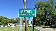 Bethel corporation limit sign
 -
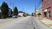 Looking west on East Plane Street in Bethel
 -
 The Starlite Drive-In


References
[edit]- ^ "ArcGIS REST Services Directory". United States Census Bureau. Retrieved September 20, 2022.
- ^ a b U.S. Geological Survey Geographic Names Information System: Bethel, Ohio
- ^ a b "Annual Estimates of the Resident Population for Incorporated Places in Ohio: April 1, 2020 to July 1, 2023". United States Census Bureau. Retrieved June 2, 2024.
- ^ a b "U.S. Census website". United States Census Bureau. Retrieved January 31, 2008.
- ^ "US Gazetteer files 2010". United States Census Bureau. Archived from the original on July 2, 2012. Retrieved January 6, 2013.
- ^ "Census of Population and Housing". Census.gov. Retrieved June 4, 2015.
- ^ "U.S. Census website". United States Census Bureau. Retrieved January 6, 2013.
- ^ "Locations". Clermont County Public Library. Retrieved February 25, 2018.
- ^ Allen, Lee (2006). The Cincinnati Reds. Kent State University Press, p. 70. ISBN 978-0-87338-886-3.
External links
[edit]Municipalities and communities of Clermont County, Ohio, United States | ||
|---|---|---|
| Cities |  | |
| Villages | ||
| Townships | ||
| CDPs | ||
| Unincorporated communities |
| |
| Footnotes | ‡This populated place also has portions in an adjacent county or counties | |
| International | |
|---|---|
| National | |